

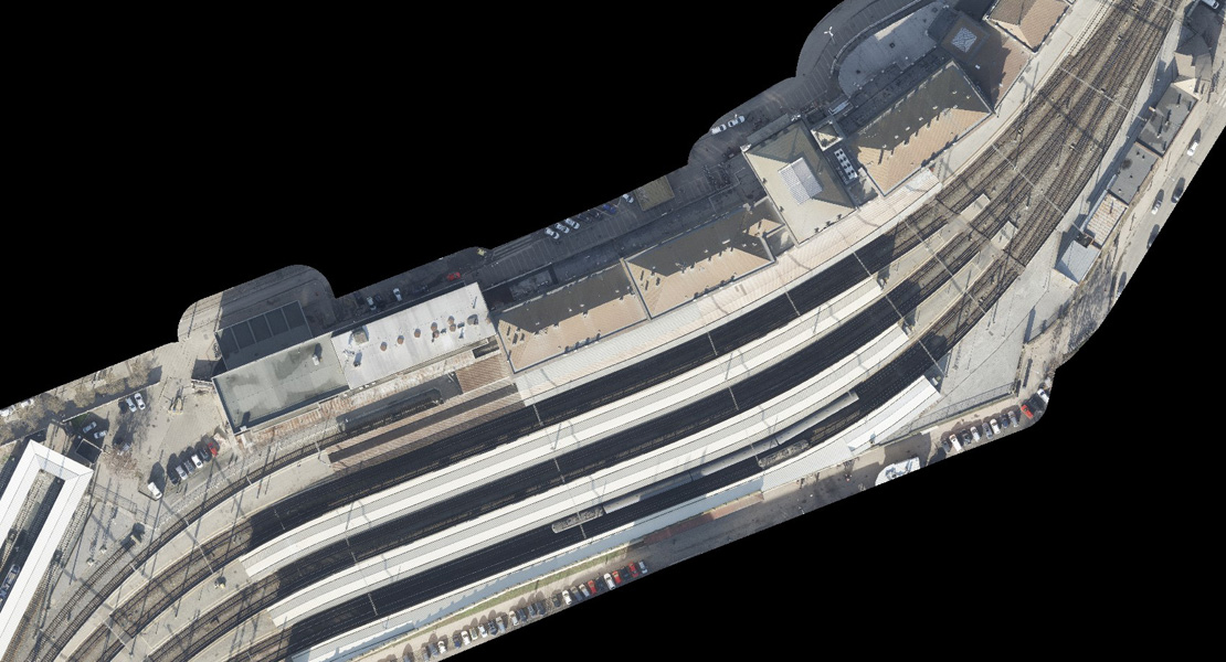
Vlakové nádraží Jaroměř, detail na železniční muzeum Výtopna Jaroměř s točnou, trueortofoto
Digital Technical Map of the Railway (czech abbreviation DTMŽ), is a project aimed at digitizing and centralizing technical and engineering information about the railway infrastructure in the Czech Republic. Its goal is to create a unified digital map of railway networks, providing clear and up-to-date information about railway components—such as tracks, switches, platforms, bridges, and other facilities.
The digital technical map is intended to enable more accurate and faster planning of maintenance and upgrades, simplify the design of new constructions, and support efficient communication between different departments of the Správa železnic (Railway Administration), government institutions, and private entities. The project aligns with the European digitization strategy, which promotes the transition to modern digital infrastructure across all modes of transport. The initiative also includes legislative updates, such as the amendment to Decree No. 393/2020 Coll., which defines the method of recording technical infrastructure data, with information updated and maintained according to new standards and regulations.
By the end of the project, a comprehensive data base will be established and continuously populated in the DTMŽ data warehouse. This database will form the foundation for fulfilling the legal requirements of the national DTM. The primary focus will be on technical infrastructure data, especially optical and metallic transmission systems.
As part of a consortium of suppliers—GEFOS a.s., HRDLIČKA spol. s r.o., GEOŠRAFO s.r.o., and PRIMIS spol. s r.o.—our role is to provide, using a combination of aerial photogrammetry and laser scanning, primary and reference data for over 7,800 km of railway lines across the Czech Republic. We are also responsible for surveying tie and control points, which, together with the Railway Control Point Network (ŽBP), are essential inputs for further data processing.
We perform full processing of nadir and oblique imagery at 2 cm resolution and point clouds with a minimum density of 24 points/m², enabling the production of high-quality reference data. The imaging is carried out either using the Vexcel UltraCam Osprey 4.1 aerial camera in combination with the RIEGL VQ®-780 II laser scanner, or with the Leica CityMapper-2 hybrid aerial camera.
In each phase of the project, besides the imagery itself, we produce aerotriangulation, cleaned and classified point clouds, and also digital terrain and surface models (DTM/DSM) in a 0.2 × 0.2 m GRID resolution. The final product for each railway section is a true orthophoto map with a 2 cm/px resolution.
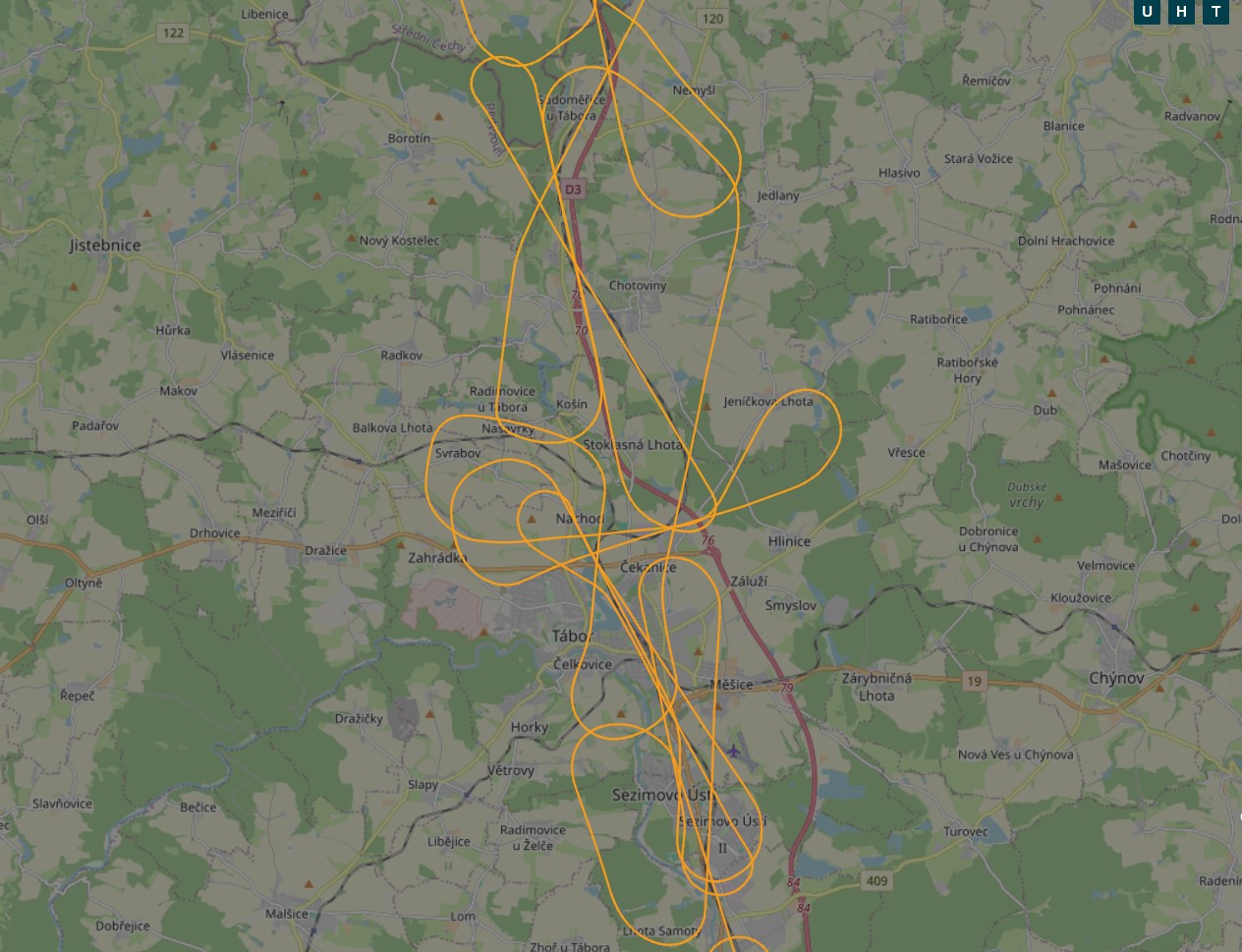
Capturing and processing data for extensive linear structures at such high resolution brings a number of specific challenges, starting already with the planning of the aerial survey flights. A high longitudinal overlap is required, and the flight path must be adapted to the elongated shape of the area—especially for meandering railway lines, which often pose the greatest challenge. Maintaining a constant flying height above the terrain is also crucial to ensure consistent pixel size with regard to the terrain relief and obstacles. The key to success lies in precise preparation, an experienced team of pilots and operators who are not thrown off by a few extra turns, and technologies capable of capturing top-quality data.


The company is registered in the Commercial Register maintained by the Regional Court in Brno, Section C, Insert 81169, since December 5, 2013
Slavíčkova 827/1a
638 00 Brno
Czech Republic
Company ID: 02402718
VAT ID: CZ02402718
+420 534 008 769