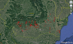
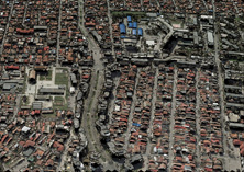
During the autumn of 2017 and spring 2018, we took photographs of 94 locations in the south of Romania and subsequently processed 10,253 images to produce a true orthophoto. The ultimate goal of the project was to map street spaces and buildings for the purposes of optimizing the electricity grid and supply points.
The photographs were taken with overlaps from 80/30 in villages up to 80/75 in cities and with a resolution of 15 cm/pixel. The area of interest covered more than 2,800 km2 in 13 administrative districts. Specifically, they were the districts of Arges, Dolj, Olt, Braila, Buzau, Calarasi, Constanta, Dambovita, Galati, Gorj, Ialomita, Valcea and Vrancea.
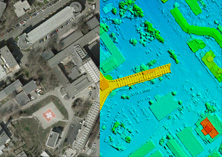
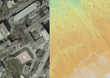
Our efforts resulted in a true orthophoto with a resolution of 15 cm and a digital terrain model created by the DIM (Dense Image Matching) method in SURE software. Due to the tight deadlines and the high time demands of computing processes, we used the new functionality of the SURE program, which allows for the controlled distribution of the calculations to other "ordinary" workstations, thus significantly shortening the machine processing. In our case, it was cut down to 1/3rd of the originally planned time.


