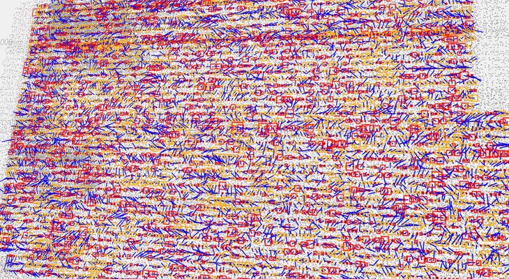
AEROTRIANGULATION
Not only will we take aerial photographs for you, we will also ensure they are correctly placed in geospace using aerotriangulation.
We apply the very latest methods using automatic correlation of pass- and tiepoints, using image projection centres determined by GNSS/INS or auto-calibration of the cameras’ inner orientation parameters during the bundle adjustment process.
We are also able to work with historical images or images from non-surveying cameras obtained by non-standard carriers.
BUĎME V KONTAKTU
Jsme tu, abychom vám poskytli individuální a profesionální služby přizpůsobené vašim potřebám. Neváhejte nás kontaktovat telefonem, emailem nebo nás přijďte navštívit.