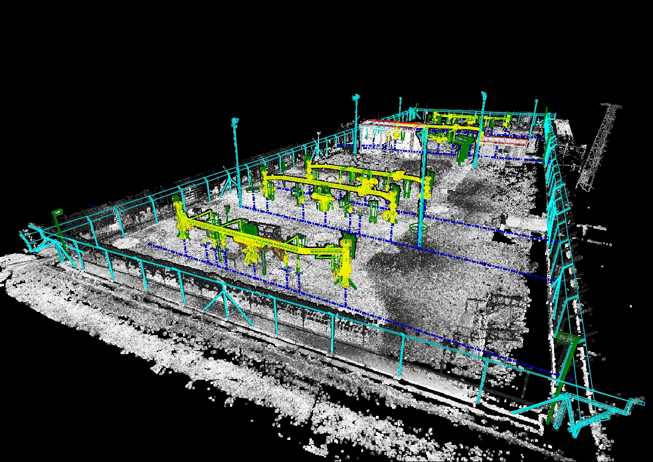
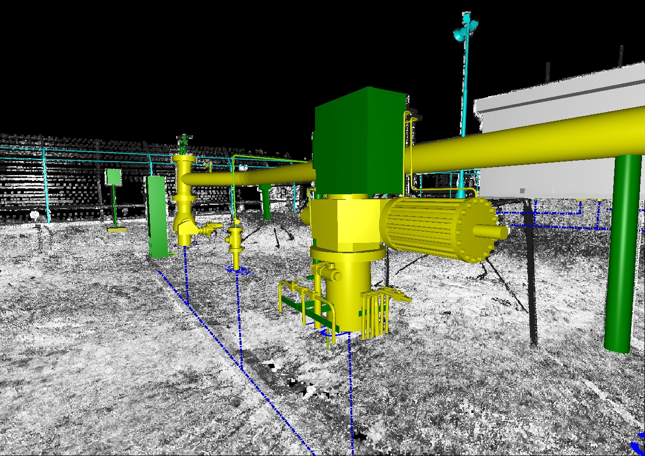
Using TLS in combination with conventional geodetic methods we surveyed three shut-off valve sites. In mid-2016, using the very precise and fast method of terrestrial laser scanning in combination with conventional geodetic methods (measuring control points), we surveyed three shut-off valve sites (SOV) in central Slovakia. Each site was scanned from an average of 37 scanning positions with an emphasis on taking detailed measurements of the pipe systems.
The scanning positions were connected and georeferenced into the S-JTSK and Bpv national coordinate and altimetric system using the ICP (Iterative Closest Point) method, after which the entire point cloud was aligned to identical control points using the least squares method.
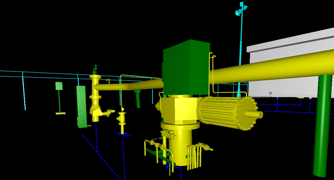
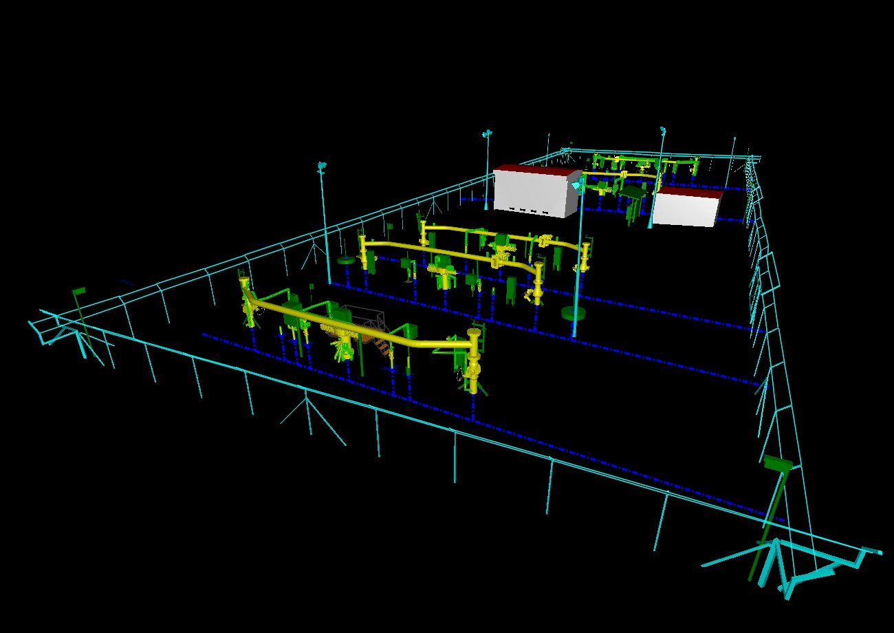
This adjusted laser data then served as the base layer for the creation of a highly detailed 3D vector model, where pipes from 1.5 cm in diameter needed to be mapped.