
High-quality imagery is not just a base layer for maps – it can also serve as a key input for scientific research. This is confirmed by a new peer-reviewed study from Aalborg University, which focused on hyperlocal mapping of urban tree canopy (UTC) in the city centre of Randers, Denmark. The objective was to design a simple, transparent, and practically applicable GIS model capable of accurately identifying where trees are actually located within a city – without relying on complex AI workflows.
The study used summer multispectral orthophotos captured by PRIMIS in 2023 with a spatial resolution of 0.2 m. The authors generated a true orthophoto (TOP) to eliminate perspective distortions and ensure spatial consistency with elevation data. Using the red (RED) and near-infrared (NIR) bands, they calculated NDVI, which served as a key layer for distinguishing vegetation from built urban surfaces. The combination of high-quality summer imagery (i.e. leaf-on imagery) and the NIR band enabled reliable identification of tree canopies even in a complex urban environment.
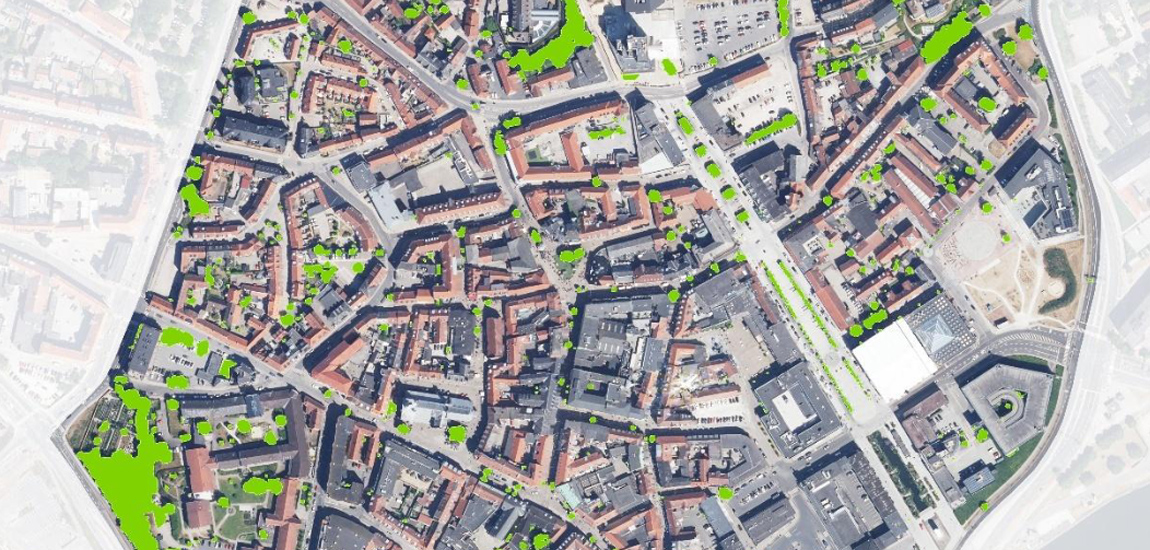
The NDVI layer was then combined with elevation data from the Danish national height model (DHM) and a building footprint layer. By applying thresholding to four parameters (non-building, height, texture, vegetation), the researchers developed an overlay model in ArcGIS Pro that classified the resulting areas as UTC. And the outcome? Within the 0.5 km² study area, tree canopy cover was calculated at 4.57%, and the model achieved an overall accuracy of 96.8% based on validation using 500 manually annotated points.
The study also highlights a broader implication: access to high-quality summer orthophotos with an NIR band can be crucial for cities planning climate adaptation strategies. Urban tree canopy maps are directly applicable for addressing urban heat and water management challenges. In this case, PRIMIS imagery was not just another dataset, but a key input that enabled the development of an accurate and practically usable model for urban planning.